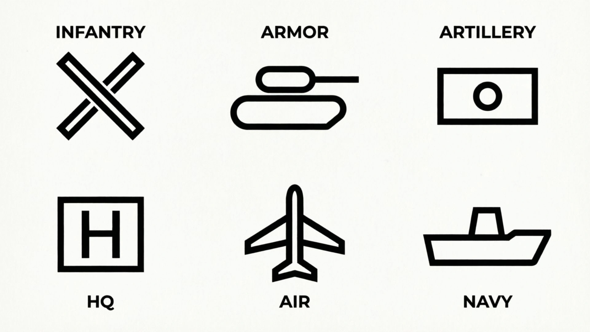
Military map symbols are standardized graphical signs used to communicate information on military maps, planning products, tactical displays, and other geographic products.
They can represent military units, equipment, activities, control measures, terrain features, installations, obstacles, and other information.
Instead of writing a long description beside every feature, military maps use a visual language that allows information to be displayed in a compact and organized way.
However, “military map symbols” is a broad term. A military map may contain military operational symbols, topographic symbols, terrain information, control measures, and other cartographic elements at the same time. Understanding the difference between these categories is one of the first steps toward reading a military map correctly.
For U.S. Army readers, FM 1-02.2 Military Symbols provides detailed guidance on military symbol construction and categories. NATO also maintains APP-06 NATO Joint Military Symbology, which provides a standardized framework for displaying joint military information.
This guide explains the major types of military map symbols, common identity and color concepts, symbol construction, terrain features, U.S. Army and NATO standards, map legends, and a practical method for identifying an unfamiliar symbol.
Important: Military symbols are standard-specific. If an unfamiliar symbol matters for training, study, or professional use, check the legend and the applicable current official publication rather than relying on an unofficial internet chart.
What Are Military Map Symbols? (Quick Answer)
Military map symbols are standardized graphics that represent military or geographic information on maps and operational displays.
Common categories include:
- Military unit symbols
- Equipment symbols
- Activity symbols
- Tactical mission task symbols
- Control measure symbols
- Planning symbols
- Obstacle symbols
- Terrain and topographic symbols
- Installation symbols
- Route and movement information
- CBRN-related symbols
- Other operational graphics
A useful way to understand them is:
Map symbol = visual representation
Legend = explanation of the representation
Symbology standard = rules for constructing and interpreting the representation
A military map can therefore be thought of as a combination of location + terrain + symbols + labels + operational information.
Military Map Symbols and Meanings: Quick Reference
The following chart provides a high-level framework rather than attempting to reproduce every symbol from an official military manual.
| Category | What it represents | Typical purpose |
| Unit symbols | Military organizations or formations | Identify organizational elements |
| Equipment symbols | Military equipment | Identify equipment categories |
| Activity symbols | Actions or activities | Show events or activities |
| Mission task symbols | Tactical mission tasks | Depict mission-related actions |
| Control measures | Boundaries, areas, routes, and other controls | Organize or coordinate operations |
| Planning symbols | Planned actions or effects | Support planning products |
| Obstacle symbols | Obstacles and related information | Show mobility restrictions |
| Terrain symbols | Physical land features | Describe the environment |
| Topographic symbols | Geographic and man-made features | Support map reading |
| Installation symbols | Facilities and locations | Identify important sites |
| Route information | Roads and movement-related features | Show transportation and movement context |
This table is intentionally broad. Official standards contain much more detailed symbol families and construction rules.
What Information Can a Military Symbol Communicate?
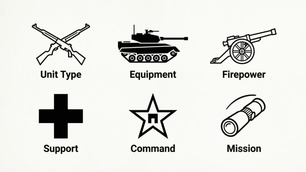
A military symbol may communicate more than simply the identity of an object.
Depending on the symbol system, information can include:
- Identity
- Function
- Category
- Location
- Status
- Organization
- Equipment type
- Activity
- Control information
- Additional descriptive information
This is why military symbology is better understood as a visual language rather than a collection of decorative icons.
A symbol may contain several components that work together.
Military Unit Symbols
Unit symbols are used to represent military organizations or formations.
A basic unit symbol may communicate a general organizational category, while additional information makes the symbol more specific.
The important point for beginners is that a unit symbol should not be interpreted only by looking at its central graphic.
You may also need to examine:
- Its frame
- Identity
- Main function
- Modifiers
- Amplifiers
- Text
- Numbers
- Other associated information
Why Unit Symbols Matter
Unit symbols allow a map or planning product to display organizational information without spelling out a full description every time.
For example, instead of writing a lengthy organizational label across a map, standardized symbology can communicate the relevant information through a compact graphic.
Do Not Memorize Every Unit Symbol at Once
Beginners often try to memorize dozens of symbols.
A better approach is to learn the construction system first.
Once you understand how frames, functions, modifiers, and amplifiers work, unfamiliar symbols become easier to investigate.
Military Equipment Symbols
Equipment symbols represent categories of equipment.
The exact graphic depends on the applicable military symbology standard.
Equipment information may be displayed independently or as part of a broader military symbol.
How to Read an Equipment Symbol
When examining an unfamiliar equipment symbol, look for:
- The main graphic
- The frame, if present
- Identity information
- Modifiers
- Amplifiers
- Labels or numerical information
- The map legend
This approach is more reliable than identifying equipment from a vague resemblance to a picture.
Military Activity and Planning Symbols
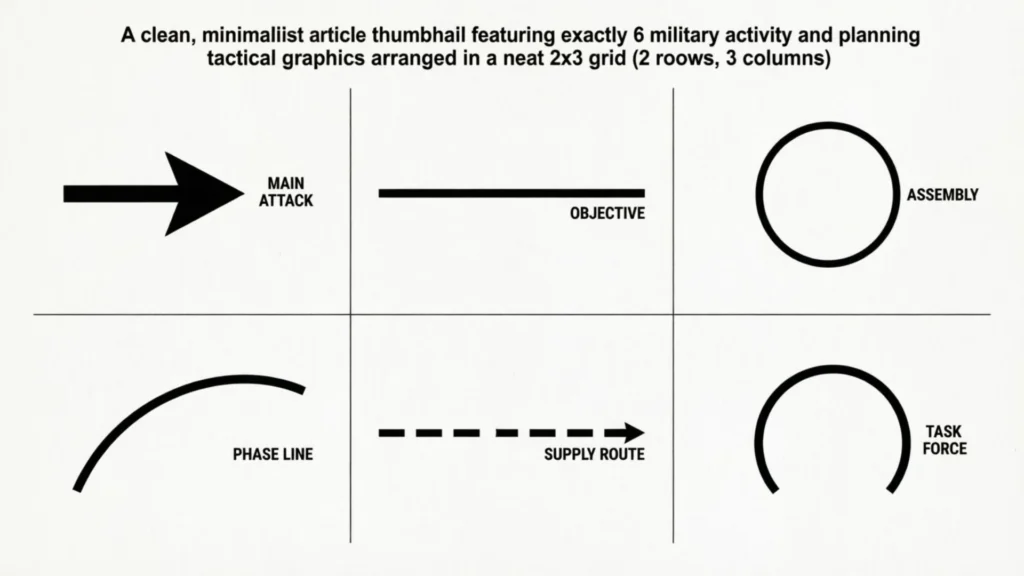
Military maps and planning products can also show activities rather than physical objects.
An activity symbol may communicate information about something occurring, planned, or represented within an operational context.
Planning symbols can be used to communicate concepts such as:
- Activities
- Events
- Effects
- Obstacles
- Areas
- Planned actions
- Other operational information
The meaning of an activity symbol depends heavily on the applicable standard and the context of the map.
Tactical Mission Task Symbols
Tactical mission task symbols are a specialized category used to represent mission-related tasks.
They can appear in military planning products such as:
- Maneuver sketches
- Course-of-action products
- Planning diagrams
- Synchronization products
These symbols are different from ordinary topographic symbols because they communicate an operational action or task, rather than simply describing a physical geographic feature.
For readers studying military map reading, it helps to keep this distinction clear:
Terrain symbol → describes the environment
Mission task symbol → describes an operational task
Military Control Measure Symbols
Control measures are another important part of military symbology.
They use lines, areas, boundaries, and other graphical structures to organize or coordinate information.
Examples can include categories related to:
- Boundaries
- Areas
- Routes
- Airspace
- Fire support
- Targets
- Movement
- Obstacles
- Other operational controls
Why Control Measures Look Different
A control measure often relies on geometry.
Instead of a single icon representing an object, a line or area may define a relationship, boundary, route, or designated space.
This is why military map reading requires more than memorizing icons.
You also need to understand how lines, areas, labels, and symbols work together.
Military Map Symbol Colors and Identities
Color can provide important information in military symbology, but it should never be interpreted without considering the applicable standard.
In a U.S. Army context, identity concepts can include categories such as:
- Friendly
- Hostile
- Neutral
- Unknown
- Assumed friend
- Pending
Colors may be used as part of the visual system for communicating identity or other categories.
Friendly
Friendly information can be represented through the applicable friendly identity convention.
The exact appearance should be confirmed against the relevant standard or map legend.
Hostile
Hostile information can be represented through the applicable hostile identity convention.
Do not assume that color alone is enough to identify every detail of a symbol.
Neutral
Neutral identifies information that falls into the applicable neutral category.
The frame, graphic, and other symbol components still matter.
Unknown
Unknown information indicates that the identity is not established according to the applicable system.
This is an important reminder that military symbology can communicate certainty or identity status, not merely object type.
Assumed Friend and Pending
Some military symbol systems include additional identity states beyond the basic friendly, hostile, neutral, and unknown categories.
These distinctions can matter in formal military products.
Why You Should Not Rely on Color Alone
A common mistake is:
“Red means one thing and blue means another, so I can identify every symbol by color.”
That is not enough.
A complete interpretation may require:
- Color
- Frame
- Main graphic
- Identity
- Modifiers
- Amplifiers
- Labels
- Legend
- Map context
Always use the applicable standard.
How Military Symbol Frames Work
One of the most useful concepts for beginners is the symbol frame.
A frame provides a structured visual boundary around certain military symbols.
Other components can then be combined with the frame to communicate additional information.
Symbol Frame
The frame provides part of the symbol’s structure and can help communicate identity or category.
It should be interpreted together with the other elements rather than treated as a complete symbol by itself.
Main Function
The main function provides the central meaning or category of the symbol.
It answers a basic question:
What kind of military element is being represented?
Modifiers
Modifiers add additional information to the basic symbol.
A modifier can make a general symbol more specific.
Amplifiers
Amplifiers provide additional information associated with a symbol.
Depending on the applicable standard, they may communicate information that would otherwise require additional text.
Why Symbol Construction Matters
Learning construction rules is more useful than memorizing isolated graphics.
If you understand the components, you can approach an unfamiliar symbol logically.
Common Military Map Symbols You Should Know
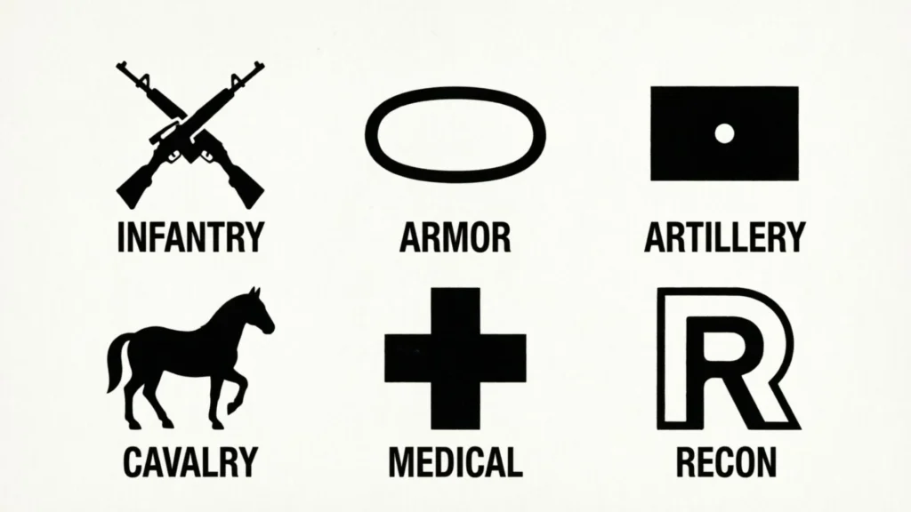
A complete official symbol catalog is too large to reproduce as a simple web list. Instead, it is more useful to understand the main families.
Unit Symbols
Used to identify military organizations and formations.
Equipment Symbols
Used to represent equipment categories.
Tactical Mission Task Symbols
Used to represent mission-related tasks.
Control Measure Symbols
Used for boundaries, routes, areas, and other operational controls.
Planning Symbols
Used to communicate planned activities, events, effects, and related information.
Obstacle Symbols
Used to represent obstacles and mobility-related information.
Installation Symbols
Used to identify certain facilities or installations.
Terrain Symbols
Used to describe physical geographic features.
Topographic Symbols
Military Terrain Map Symbols
Military map reading is closely connected with terrain analysis.
A map is not only a picture showing where something is located. It also helps the reader understand the physical environment.
Hill
A hill is a raised area of terrain.
On a topographic map, contour patterns help communicate elevation and landform shape.
Ridge
A ridge is an elongated area of higher ground.
Recognizing ridges can help a reader understand the structure of the surrounding terrain.
Valley
A valley is a lower area between elevated terrain.
Its shape and relationship with surrounding contours can help identify drainage and movement corridors.
Saddle
A saddle is a lower area between two higher points.
It can be visualized as a low connection between elevated areas.
Depression
A depression is an area of lower ground surrounded by higher terrain.
Topographic conventions are used to distinguish it from other landforms.
Draw
A draw is a small valley or drainage feature.
It can be important when studying how terrain channels movement or water.
Spur
A spur is a projecting ridge or finger of higher ground extending from a larger elevated area.
Cliff
A cliff represents a steep or nearly vertical change in elevation.
Why Terrain Features Matter
Military map reading often combines terrain features with grid coordinates, routes, and other map information.
This allows a reader to understand not just what is on the map, but how the terrain relates to movement, visibility, obstacles, and other geographic considerations.
Military Map Symbols vs. Topographic Map Symbols
These terms are closely related but are not identical.
| Military information | Topographic information |
| Units | Roads |
| Equipment | Rivers |
| Tactical tasks | Buildings |
| Control measures | Vegetation |
| Operational activities | Elevation |
| Planning information | Terrain features |
| Military installations | Geographic features |
A military map can contain both types.
For example, a road is a geographic feature, while a military symbol placed near that road may represent a unit or another operational element.
The Simple Difference
Topographic symbols describe the map environment.
Military symbols add military information to that environment.
This distinction is one of the most important concepts for beginners.
Military Map Symbols vs. Tactical Military Symbols
The phrase military map symbols is broad.
Tactical military symbols are a more specialized part of military symbology used for operational and tactical information.
For example:
- A contour line describes terrain.
- A road symbol describes infrastructure.
- A unit symbol identifies a military organization.
- A control measure can define an operational boundary.
- A tactical mission task symbol can communicate a mission-related task.
Therefore, “military map symbol” should not automatically be interpreted as “tactical symbol.”
U.S. Army Map Symbols
The U.S. Army maintains formal military symbology guidance.
For current U.S. Army study, FM 1-02.2 Military Symbols is particularly important.
It organizes military symbology into extensive categories covering topics such as:
- Military symbols
- Equipment
- Control measures
- Route information
- Countermobility
- Minefield control measures
- Field fortifications
- Airspace coordination
- Fire support coordination
- Targets
- Target acquisition
- CBRN-related markers
- Tactical mission tasks
- Task organization
- Combat effectiveness
This demonstrates why a simple internet infographic cannot replace a complete official reference.
FM 1-02.2
FM 1-02.2 provides formal Army guidance for military symbols and their construction.
If you are studying Army symbology, use the current edition rather than relying on an old symbol chart.
Army Symbol Identities
Identity is an important component of military symbology.
Depending on the symbol system, identity can distinguish categories such as friendly, hostile, neutral, or unknown.
Army Symbol Construction
Army symbols are not necessarily single drawings.
They can be constructed using multiple components.
Understanding those components is one of the best ways to move from beginner-level recognition to more advanced interpretation.
NATO Military Map Symbols
NATO uses a standardized approach to joint military symbology through APP-06 NATO Joint Military Symbology.
The goal is to provide a common graphical language that can be used across military systems and manual applications.
This becomes particularly important in multinational environments where different countries may otherwise use different terminology, conventions, or visual representations.
NATO APP-06
APP-06 provides a structured framework for military symbols and their construction.
It is designed for use in both electronic and manual environments.
Why NATO Standardization Matters
Military operations can involve personnel and systems from multiple nations.
A common symbology framework can improve:
- Interoperability
- Communication
- Recognition
- Information sharing
- Common understanding
NATO vs. U.S. Army Symbology
NATO and U.S. Army symbology are related but should not simply be assumed to be identical in every detail.
| U.S. Army | NATO |
| Uses Army-specific doctrine and references | Uses NATO joint standards |
| FM 1-02.2 is a key military-symbol reference | APP-06 is the NATO joint symbology framework |
| Supports Army operations and training | Supports multinational interoperability |
| Includes detailed Army symbol categories | Provides NATO joint military symbol standards |
If a map or training product identifies the standard it uses, follow that standard.
Military Map Legend: How to Read It
A map legend is the key that explains the symbols and conventions used on a particular map.
For a beginner, the legend should be one of the first things to examine.
What a Legend Can Explain
Depending on the map, a legend may explain:
- Symbols
- Colors
- Lines
- Patterns
- Abbreviations
- Terrain features
- Geographic features
- Special map conventions
Why the Legend Is More Important Than a Random Internet Chart
A generic chart may come from:
- Another country
- Another military organization
- An older publication
- A different map series
- A different symbology standard
- An unofficial source
The legend belongs to the specific map you are reading.
Therefore:
Map legend first → official standard second → unofficial reference last.
How to Identify an Unknown Military Map Symbol
If you see an unfamiliar military symbol, do not guess from its appearance alone.
Use this process.
Step 1: Identify the Map
Determine what you are looking at.
It could be:
- A topographic map
- A military planning product
- A training diagram
- A digital operational display
- A NATO product
- A national military map
Step 2: Check the Legend
Look for the map’s key.
The legend may immediately identify the symbol.
Step 3: Identify the Symbol Category
Ask whether the symbol appears to represent:
- A unit
- Equipment
- An activity
- A control measure
- A planning element
- An obstacle
- Terrain
- An installation
Step 4: Examine the Frame
If there is a frame, study its shape and construction.
Do not interpret it independently of the rest of the symbol.
Step 5: Check Identity
Determine whether the symbol communicates an identity category such as friendly, hostile, neutral, or unknown.
Step 6: Examine the Main Graphic
Look at the central function or graphic.
This can help identify what kind of element is represented.
Step 7: Look for Modifiers and Amplifiers
Small additions can provide important details.
Do not ignore them simply because they look secondary.
Step 8: Consider Color
Use color as supporting information rather than the sole method of identification.
Step 9: Read the Surrounding Map
Look at nearby:
- Roads
- Terrain
- Boundaries
- Labels
- Routes
- Other symbols
Context can help explain what the symbol is doing on the map.
Step 10: Verify the Standard
If you still cannot identify it confidently, check the applicable official reference.
This ten-step process is much safer than trying to recognize every military symbol from memory.
Military Grid References vs. Map Symbols
A common beginner mistake is confusing what something is with where it is.
A map symbol primarily communicates information about a feature, object, activity, or military element.
A grid reference helps communicate its location.
For example:
Symbol → what is represented
Grid reference → where it is located
Military maps can combine both systems to communicate geographic information efficiently.
Military Map Reading and Terrain Analysis
Military map reading involves more than symbol recognition.
A reader may need to understand:
- Grid coordinates
- Contour lines
- Terrain features
- Topographic symbols
- Distance
- Direction
- Elevation
- Routes
- Map scale
Terrain association is especially important because map features can be related to real-world terrain.
A strong map reader learns to connect:
Map → terrain → location → symbol → context
rather than treating every symbol as an isolated picture.
Military Map Symbols for Beginners
If you are completely new to military map reading, do not start by trying to memorize an entire military-symbol manual.
Start with the basics.
Learn the Map Legend
Understand what the specific map is showing.
Learn the Major Terrain Features
Start with:
- Hill
- Ridge
- Valley
- Saddle
- Depression
Then learn smaller terrain features.
Learn Basic Symbol Categories
Understand the difference between:
- Unit
- Equipment
- Activity
- Control measure
- Terrain
- Installation
Learn Identity Concepts
Understand that military symbology can distinguish categories such as friendly, hostile, neutral, and unknown.
Learn Symbol Construction
Once you understand frames, functions, modifiers, and amplifiers, more complicated symbols become easier to study.
Practice With Realistic Examples
Do not only memorize names.
Look at a map and ask:
- What type of information is this?
- What does the symbol represent?
- What identity does it show?
- What does the surrounding terrain tell me?
- What does the legend say?
- Which standard applies?
This creates understanding rather than simple memorization.
Common Mistakes When Reading Military Map Symbols
Assuming Every Military Symbol Is Universal
Different standards can use different conventions.
Always identify the applicable system.
Ignoring the Legend
The map legend is often the fastest way to resolve uncertainty.
Reading Color Without Context
Color can be useful, but it is only one part of the symbol system.
Ignoring Modifiers
A small addition may change or refine the meaning.
Ignoring Amplifiers
Additional information can be attached to a symbol through amplifiers or related components.
Confusing Terrain and Tactical Symbols
A hill symbol describes terrain.
A military unit symbol communicates military information.
They serve different purposes.
Using an Outdated Chart
Military standards and publications can be revised.
A symbol chart from an old training document may not represent the current standard.
Assuming a Similar-Looking Symbol Has the Same Meaning
Visual resemblance is not enough.
Use the official definition.
Trying to Memorize Everything
Understanding the construction system is generally more useful than memorizing hundreds of isolated graphics.
Why Military Map Symbols Are Important
Military maps may need to communicate large amounts of information in a small amount of space.
A standardized symbol can communicate information faster than a long written description.
This becomes especially valuable when multiple people need to interpret the same operational picture.
Standardization is also important for multinational cooperation.
A common visual language reduces the need to translate every graphic description between different organizations and languages.
What Military Map Symbols Do Not Tell You by Themselves
A symbol should not be interpreted as a complete information package in isolation.
Depending on the map and standard, the symbol alone may not tell you:
- The complete location
- The entire status of an element
- Every organizational detail
- The map’s scale
- The meaning of surrounding graphics
- The applicable operational context
- Every detail contained in the legend
The most reliable interpretation comes from combining:
Symbol + legend + context + applicable standard
This is one of the most important principles for anyone learning military map reading.
Military Map Symbols vs. Military Map Icons
The word icon is often used casually for any small graphic.
Military symbology is more structured.
A military symbol can contain:
- A frame
- Main function
- Identity
- Modifiers
- Amplifiers
- Color
- Text
- Numerical information
An icon is generally thought of as a simple graphical representation.
Therefore, describing military symbology as nothing more than “military icons” can make the topic seem simpler than it really is.
Frequently Asked Questions About Military Map Symbols
What are military map symbols?
Military map symbols are standardized graphics used to represent military units, equipment, activities, control measures, terrain, installations, and other information on maps and operational displays.
What are the main types of military map symbols?
Major categories include unit symbols, equipment symbols, activity symbols, tactical mission task symbols, control measures, planning symbols, obstacle symbols, installation symbols, and terrain or topographic symbols.
What do military map symbols mean?
Their meanings depend on the symbol, its components, the map legend, and the applicable military standard. A symbol may communicate identity, function, equipment, activity, location-related information, or operational control information.
What are Army map symbols?
Army map symbols are standardized graphical representations used by the U.S. Army to communicate military information. FM 1-02.2 is the current Army military-symbol reference for this subject.
What is FM 1-02.2?
FM 1-02.2 is the U.S. Army publication Military Symbols. It provides detailed guidance on military symbols, construction, categories, and related information.
What is NATO APP-06?
NATO APP-06 is the NATO framework for joint military symbology. It provides a standardized graphical approach for displaying military information in manual and electronic environments.
What do colors mean on military maps?
Colors can communicate identity or other information, but their exact meaning depends on the applicable standard. Color should always be interpreted together with the symbol’s construction and the map legend.
What does blue mean on a military map?
In the applicable U.S. Army identity-color system, blue can be associated with friendly information. However, users should verify the exact convention against the relevant map legend and standard.
What does red mean on a military map?
In the applicable U.S. Army identity-color system, red can be associated with hostile information. Color alone should not be used to interpret an unfamiliar symbol.
What are military terrain symbols?
Military terrain symbols and topographic conventions represent physical features such as hills, ridges, valleys, saddles, depressions, draws, spurs, cliffs, roads, water features, and other geographic information.
What are the five major terrain features?
Traditional military land-navigation instruction commonly teaches five major terrain features: hill, ridge, valley, saddle, and depression.
What are the minor terrain features?
Commonly taught minor terrain features include draw, spur, and cliff.
What is the difference between a military symbol and a topographic symbol?
A military symbol generally communicates military or operational information, while a topographic symbol represents geographic or physical features of the map environment.
Are NATO and U.S. Army military symbols the same?
They are related through broader military standardization efforts, but they should not automatically be assumed to be identical in every detail. NATO uses APP-06 for joint military symbology, while the U.S. Army maintains its own military-symbol doctrine.
What is a military map legend?
A military map legend is the key that explains the symbols, colors, lines, patterns, abbreviations, and other conventions used on a particular map.
How do I identify an unknown military map symbol?
Start with the map legend, identify the symbol category, examine the frame and main graphic, check identity and color, look for modifiers and amplifiers, consider the surrounding map context, and then verify the symbol against the applicable official standard.
Do military map symbols appear on digital maps?
Yes. Modern military symbology can be used in electronic and automated systems as well as manual map products.
Do I need to memorize every military map symbol?
No. It is more useful to understand the main categories and the basic construction system, then use the appropriate official reference when you encounter an unfamiliar symbol.
Where can I find official military map symbol information?
For U.S. Army symbology, consult current Army publications and training resources, particularly FM 1-02.2. For NATO joint military symbology, consult the applicable edition of NATO APP-06.
Official Military Map Symbol References
For serious study, use authoritative references instead of relying entirely on third-party symbol charts.
U.S. Army FM 1-02.2
The U.S. Army’s Military Symbols publication is the primary reference for current Army military-symbol information.
U.S. Army Map Reading and Land Navigation Resources
Army training resources also provide instruction on map reading, land navigation, topographic symbols, terrain features, and military symbology.
NATO APP-06
NATO APP-06 provides the joint military symbology framework used to support standardized military graphical representation and interoperability.
Why Official Sources Matter
An unofficial military-symbol chart may be:
- Outdated
- Incomplete
- Country-specific
- Simplified
- Based on a previous standard
- Missing modifiers
- Missing amplifiers
- Designed for a particular software system
For casual learning, a simplified chart can be helpful. For formal study or professional interpretation, use the applicable official source.
Conclusion
Military map symbols are much more than a collection of small icons. They form a structured visual language that can communicate military units, equipment, activities, tactical tasks, control measures, terrain, installations, and other information.
For beginners, the most useful starting point is to understand the difference between military symbols and topographic symbols. Topographic information describes the physical environment, while military symbology adds operational information to that environment.
You should also learn how frames, identities, colors, modifiers, amplifiers, and other components work together. Rather than trying to memorize every symbol, learn the construction system and then use the map legend and official reference to identify unfamiliar examples.
The U.S. Army and NATO provide formal standards for military symbology, but those standards should not automatically be treated as interchangeable. Always determine which standard applies to the map or product you are reading.
Most importantly, remember this simple formula:
Symbol + legend + context + applicable standard = reliable interpretation.
That approach makes military map reading easier, more accurate, and much more useful than memorizing isolated symbol pictures.

Dylan Anderson is a writer who enjoys turning complex topics into simple, engaging content that readers can actually use. His work focuses on clear explanations, practical insights and storytelling that feels natural and relatable. He is also the fictional author of The Quiet Compass of Ashford and Where the Cedar Lantern Glows. When he’s away from his keyboard, Dylan enjoys hiking, reading, and discovering inspiration in everyday life. He believes great writing should be informative, easy to understand and enjoyable from beginning to end.
 Adam Sullivan